To save paper & ink, use the [Hide] controls next to photos and comments
so you only print what you need.
North Face Right Gully
WI3 Mod. Snow,
Trad, Ice, Snow, Alpine, 5300 ft (1606 m), 3 pitches, Grade IV,
 Avg: 3.9 from 25
votes
Avg: 3.9 from 25
votes
FA: Mark Weygant, Arthur Emmons, Orville Emmons - Aug 26, 1928
Oregon
> Oregon Volcanoes
> a. Mt Hood
> N Side
Description
This elegant route is one of the best on the mountain. The crux is catching the line in condition. When the conditions are right, this is a spectacular climb that can have fantastic ice pitches up to WI4.
Begin at Tilly Jane or Cloud Cap campgrounds. Follow marked climber trails through the trees. Moving above timberline climb onto a prominent ridge (the lower part of Cooper Spur) Continue up the ridge until you see a cairn on the right side of the trail marking a subtle path down onto the glacier.
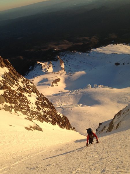
Move up the glacier sticking to the left side and watching for seracs and crevasses. There are several nice ice lines that have been forming on the left side of the Eliot headwall. Continue up the glacier and move right after you near the headwall.
On the right side of the headwall, there are 2 distinct couloirs heading up and diagonally leftward. Both can be climbed, but the right one is usually the more exciting route with more vertical ice.
Move into the gullies and follow them to the summit.
The left gully has a vertical section at its beginning then is pretty much a snow slope to the summit.
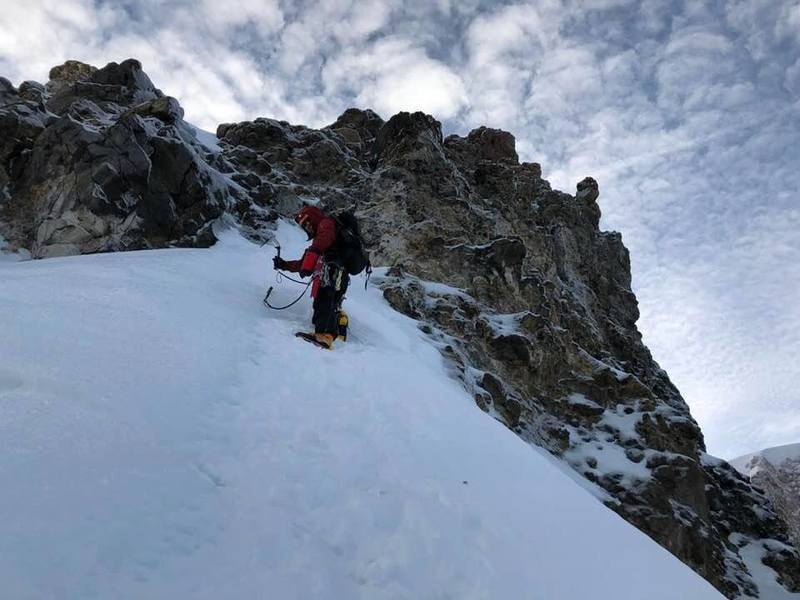
The right gully contains 3-4 vertical ice sections with the first two being the most difficult.
Descend Cooper Spur or Sunshine to return to start or descend the south side route and make a car shuttle.
Protection
6-8 short screws, pickets, 60m rope

[Hide Photo] Just above the 2nd ice step.
[Hide Photo] Crossing the Eliot Glacier. The north face route goes up either of the two couloirs above the climbers head.
[Hide Photo] Soloing the NFRG upper ice step
[Hide Photo] Mike Getlin leading through the second and (more difficult) ice step.


 Continue with onX Maps
 Sign in with Facebook


Phoenix, AZ
Sacramento, CA
More than one climber has climbed the route when it is just a long snow ramp. While still a fun route I would say what makes it my favorite route on the mountain is the WI steps. Sep 20, 2006
Do not underestimate the descent in the Fall! Jul 16, 2007
Bend, OR
It can be a mental kick in the head to pull through what you thought were the end of the difficulties and realize you're not out of the woods yet. Mar 14, 2011
On the road to perdition
Bend, OR
Your moms house last night
Portland OR
If the road is closed above Cooper Spur Ski Resort, you will have to park at the Tilly Jane trailhead. It is approximately 2¾ miles or about 1.5 to 2 hours by trail to Tilly Jane campground. From the Tilly Jane campground, it is another hour to the large cairn, which marks the trail off the Cooper Spur Ridge down to the Eliot Glacier. If on approach you arrive at the stone shelter on Cooper Spur ridge, the cairn is almost due east and nearly the same elevation as the shelter and on a sub-ridge between the main Cooper Spur Ridge and the Eliot Glacier. Depending on your wanderings it is approximately 3.3 miles from Tilly Jane campground (the A-Frame) to the bergschrund at the start of the North Face route. Plan on 5 to 6 hours hiking from Cooper Spur Ski Resort to the base of the climb. Mar 21, 2015
Portland
Gear: 3 pickets, 7 screws, a few tricams and front pointing calf muscles.
A short video my climbing partner made of our climb. I did all the leading. We pitched out the Bergschrund and the 2nd ice step. Everything between we simul-climbed. We soloed to the summit after the 2nd ice step.
youtube.com/watch?v=lnqbOjI…
Note: A little bit of passive rock gear is sometimes the only gear you get after the 2nd ice step and it should be added to the description. Dec 14, 2017
Seattle, WA
Seattle, WA
Berkeley, CA
We climbed it in a single push May 29, 2021, which in retrospect was not a great time. The sun cooked the gullies from the moment it rose at 5:30am until we got to the top, greatly increasing the falling rock and ice hazard.
If I were going to do it again, I would either leave in the evening (instead of midnight) or do it earlier/later in the season when the sun isn't up as long. Jun 12, 2021