
 Continue with onX Maps
 Sign in with Facebook


PSA: Majority of Mt. Charleston climbing still closed for summer of 2024


|
|
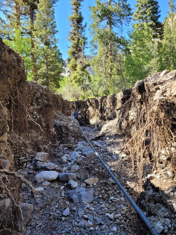
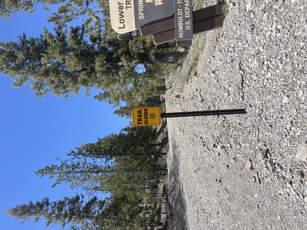
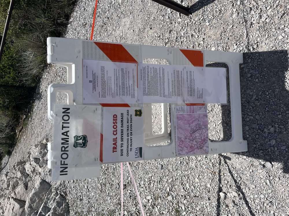
I haven't seen too many updates but have gotten some boots-on-the-ground info. Trail Canyon, Mary Jane, Echo, etc. trails are still all closed. This means the following crags will likely not be open this summer: That does not leave too many options for high-elevation summer climbing in Vegas. So: Mostly I'm posting this for the people traveling long distances for The Hood. The Hood is not open/likely will not open this year. If I hear any updates or changes, I'll re-post here. |

|
Thanks for posting Charlie, you’re a mensch. |
|
|
Thanks charlie. I havent really kept up with this, what was the original reason for the closure? |
|
|
slim wrote: When Hurricane Hilary came through, it decimated the roads and trails around Mt. Charleston. All the roads needed substantial repairs due to washouts. Those repairs were completed just in time before winter.
|

|
I was going to add that NFS will most likely just keep south loop trail head closed as a way to enforce cathedral closure. Effectively closing all of any south loop crags to all but us residents. There is actually a whole lot open. Like a lot. The book has many crags listed that are not in the closure areas. Granted, except for the Roost, not as convenient as many of the Mary Jane zones, but clubhouse, starter, pirates cove, glass house, tree house, observatory, sun house, roost, blue sky bluff, ice house, roadkill, subway, Lee canyon boulders. Also Harris Mtn trailhead is free of snow now and the road isn’t washed out. That’s the access that rangers are suggesting to hike south loop. Just need some clearanceAWD Plenty to do.
|
|
|
Andrew Raether wrote: Thanks for the info, Andrew. Any ideas on why trail canyon trail/trailhead is closed at all? |
|
|
B B wrote: Hurricane Hilary hit us last year and wiped out a lot of the trails and infrastructure up there last year. |
|
|
EMFR I wrote: I heard about that hurricane. But there isn’t any damage to trail canyon or the trailhead, only a short section of dirt road that can be bypassed or driven across. So why the closure to that trailhead and trail? |
|
|
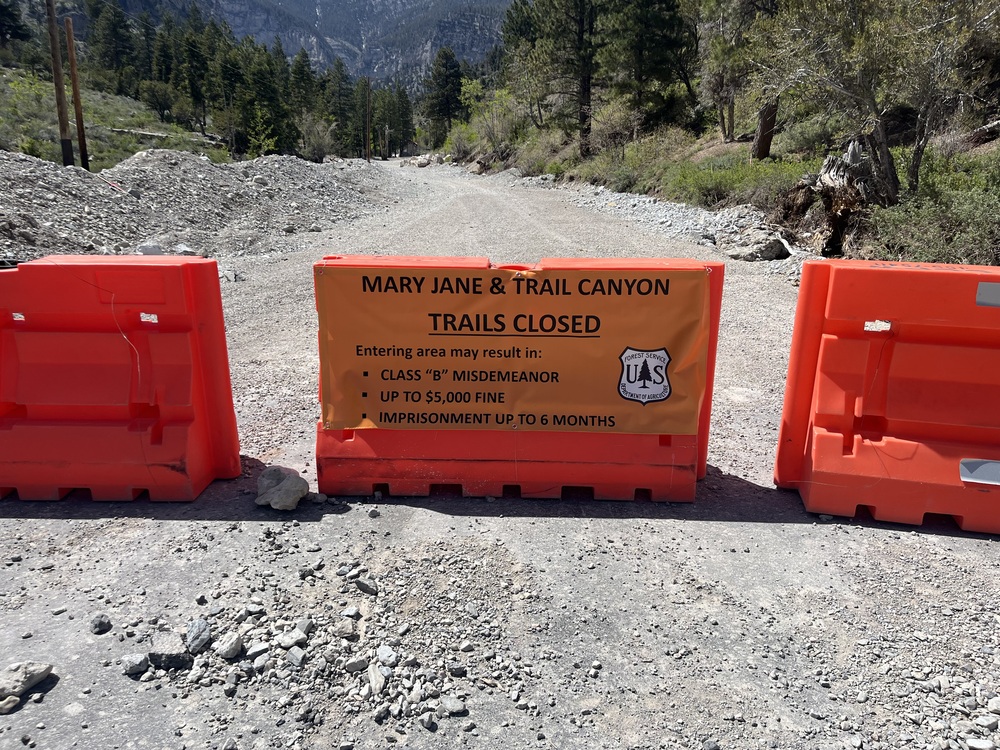
There was a lot of damage in trail canyon from 2023 spring melt. Trail wasn’t closed. Then the Hurricane rolled through. I think there was some more damage. Trail closed. My guess is NFS really has no ability to police anything up here and keeping trail canyon open makes it impossible to police for Mary jane. Had a pleasant conversation with NFS ranger and they’re trying but they can not promise anything that’s currently closed to be opened in 2024. If last summer/fall is any indication the tickets they’ll hand out will be exceptional. Last year the tickets were up to $5k for trespassing and I heard of several that were handed out from $1-5k. Tempting fate is very not recommended. Keep in mind When the 2013 fire and flooding occurred Harris mtn trail was closed till 2019. |
|
|
B B wrote: Uhm…where were you? https://twitter.com/humboldttoiyabe/status/1693646139323810147?s=46 https://twitter.com/humboldttoiyabe/status/1696359740035764373?s=46 https://twitter.com/humboldttoiyabe/status/1704614342233292868?s=46 |
|
|
 |
|
|
Yeah that definitely looks like Mary Jane. Also for keep in mind regardless of how absolutely draconian the maximum penalty for trespassing in the closure areas is $5000 and 6 months in jail. It is some absolutely outrageous fascist BS, but they were slinging multi-thousand dollar fines last fall and they will definitely do it again. |
|
|
I think there is still a large amount of people that don't understand what is happening up there. There are a few trails that recieved significant damage, but most of the closures are areas that are completely fine to hike/hang out/ and climb. We should still be allow to recreate in those closed areas. This closure affects a large diverse group of people, not just climbers. I'm sure many of you have seen the families that picnic in the trees and use this area to escape the heat of Las Vegas. At this point the NFS should have everything open, the parking lots especially. On a separate note, if someone wants to travel on that damaged trail, it shouldn't be illegal, it's public land and our choice if we want to hike " off trail". But irregardless of the damaged trails, at a minimum we we should able to use the land around Mary Jane falls trail. |
|
|
Sarah-Min Donahue wrote: Absolutely 100% |
|
|
Do we have any contacts with the local USFS to talk with about this? |
|
|
Charlie S wrote: Mr. Jon Stansfield is the new Humbolt Toiyabe National Forest supervisor : 775-355-5309 Jon.stansfield@usda.gov And Spring Mountain National recreation Area, Area Manager: 702-515-5448 Deborah.macniell@usda.gov |
|
|
The email to Deborah doesn’t go through. There may be a new manager: Randy.Kyes@usda.gov I was directed to him by the person you listed. |
|
|
From Twitter/X: “#MemorialDay weekend, 2 miles of Mack’s Canyon Road & Lower Bristlecone Trailhead & Trail reopens on #SpringsMountainsNRA. Echo Trailhead & Little Falls Trail will open sometime this year, but still be closed over holiday. @GoMtCharleston @ClarkCountyNV” |
|
|
I didn't even know there were Bristlecones in the area. |
|
|
   Upper Bristlecone, lower bristlecone, and trail canyon/mary jane. Disgusting government overreach. We know what's best for you. |
|
|
SNCC posted an update that several trails are planned to open for the summer. Anyone have more details or timing estimates? 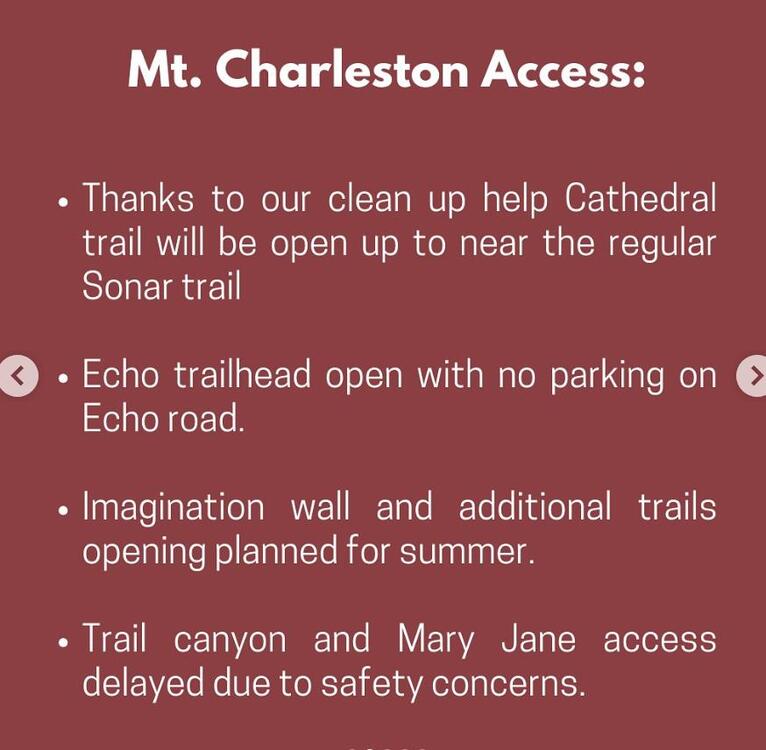 |


