
 Continue with onX Maps
 Sign in with Facebook


Find walls and boulders using LIDAR data
|
|
Detailed shaded maps of terrain based on LIDAR data are available at https://apps.nationalmap.gov/3depdem/ Here's an example map (most of the US has data). You can see boulders as little bumps scattered around the landscape. The rock walls are the bigger dark areas. You can also see the roads, house plots, and trails. 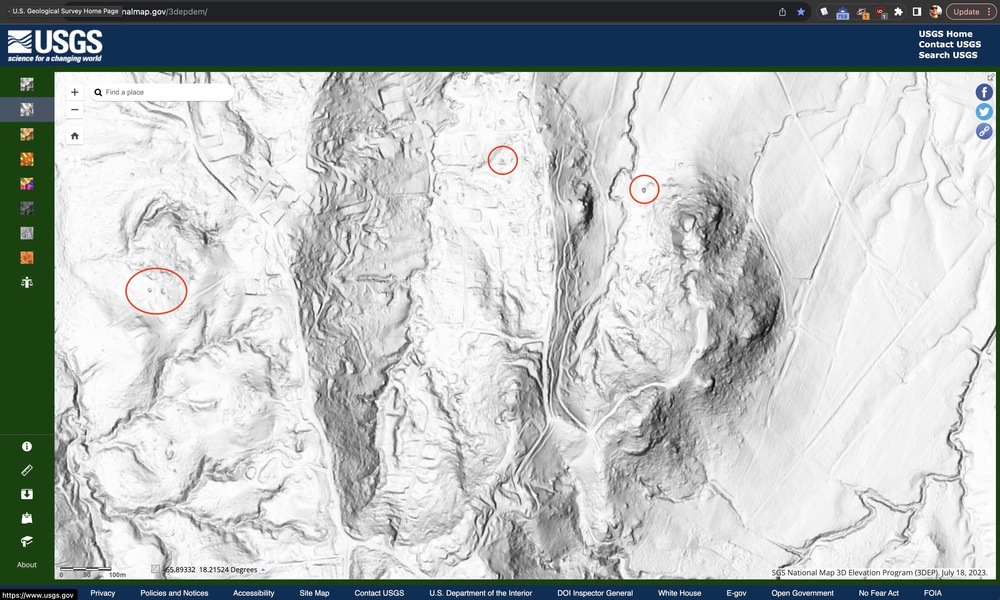 LIDAR survey coverage is shown on this map: |
|
|
If you need more details, you can open the 3D model of the LIDAR data and interact with the model in order to really analyze and understand the shape of the area. Find a LIDAR dataset from the USGS. Two ways are shown in the following screenshots: 1) https://portal.opentopography.org/datasets, 2) https://usgs.entwine.io 1) Click on the map and click on one of the datasets listed there. You get this screen: 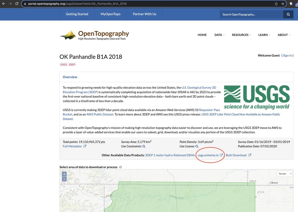 2) Click on the map at https://usgs.entwine.io: 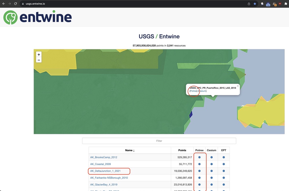 So now you'll be in the Potree 3D viewer, which is not exactly user friendly. You'll need to open the settings menu in the top left corner, and make some changes: 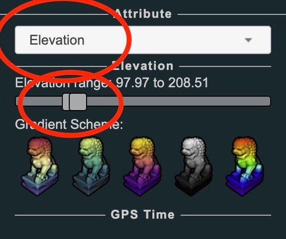  Worst part? There's no way to enter GPS coordinates that I could find. So you'll need to play with the elevation range slider to color the map in a way that you can recognize the features and zoom in manually (or compare to Google Maps' terrain mode): 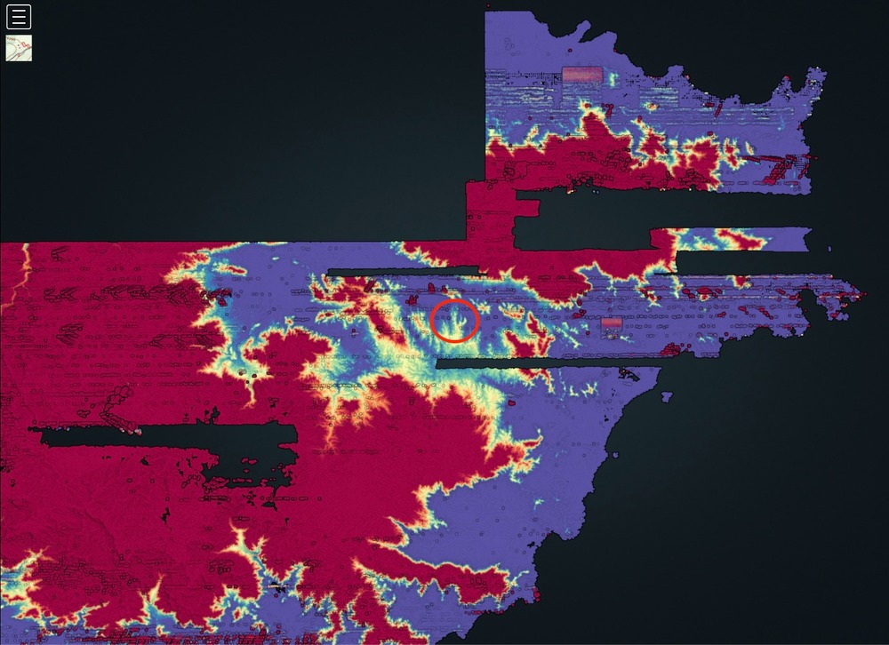 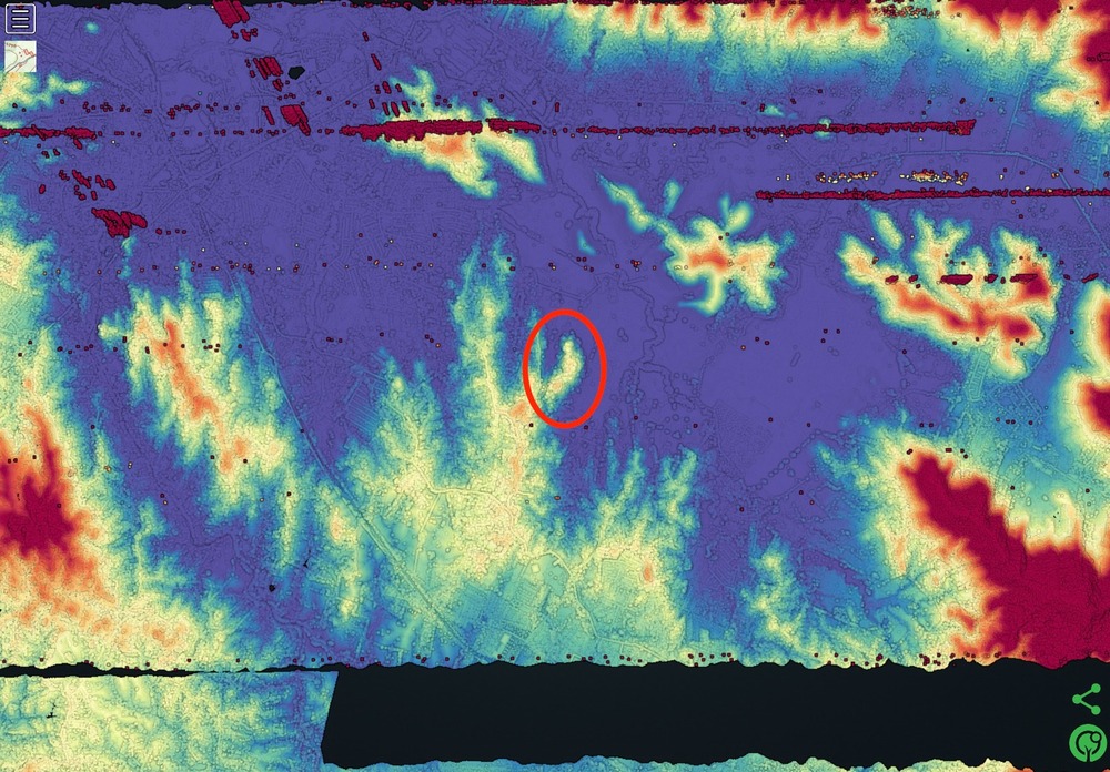 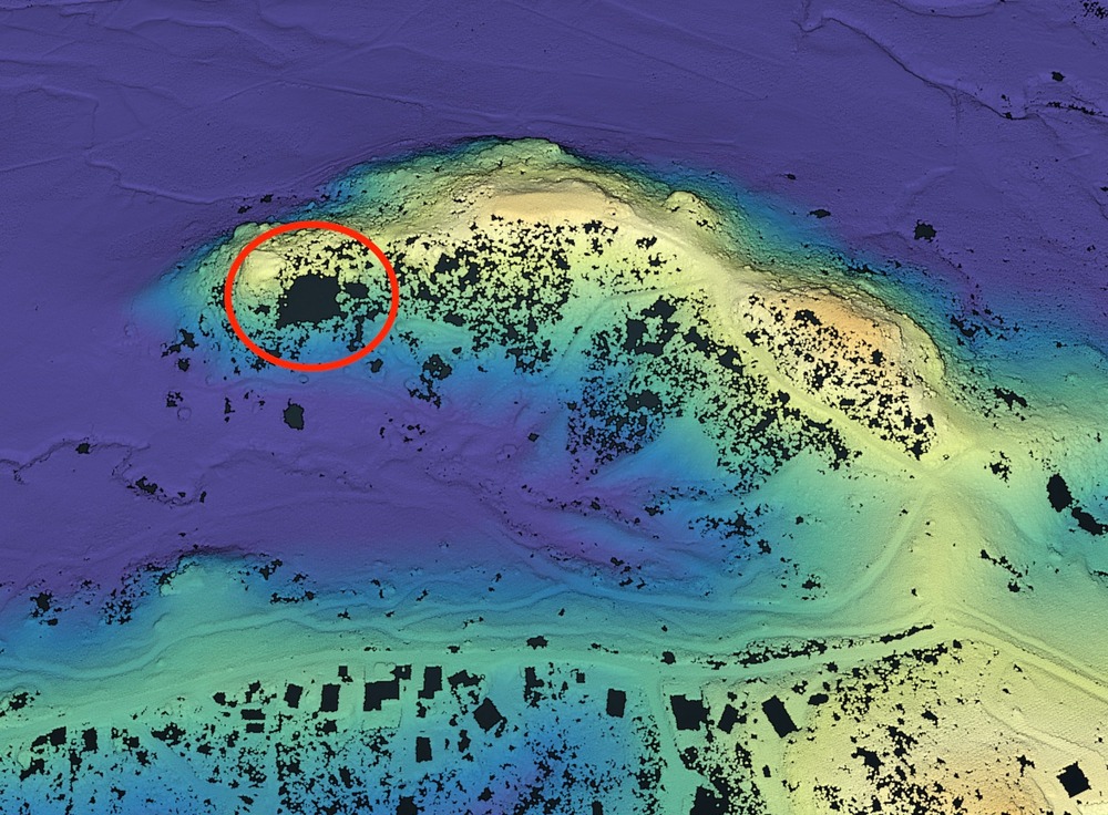 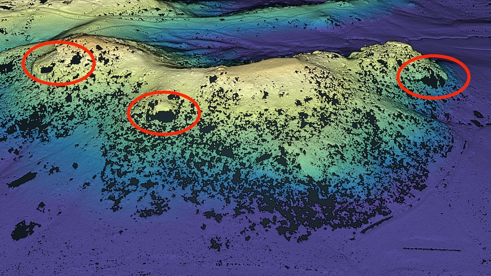 There you go! A bunch of small rock walls! They show up as holes in the fabric of the landscape. The rectangular black holes are houses. If you check many mapping websites, you'll eventually find one that has detailed satellite imagery. In my case, Puerto Rico's government offers a land registry web portal, and I found this detailed view of the same area: 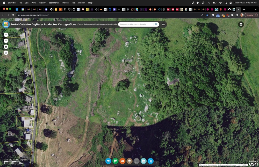 You can check: Google Maps, Bing Maps, Wikiloc, onX. Scribble seems especially detailed. ArcGIS seems detailed too. Change the basemap to see the satellite imagery. Lastly, for very recent data of varying detail, see these two: Sentinel-Hub EO Browser (click the left/right arrows next to the date) Happy searching! |


|
QGIS is quite useful for analyzing this raster lidar data. I'm sending a talk proposal to an upcoming GIS conference to present the techniques I've used for lidar cliff detection. |
|
|
Quit giving away my secrets. Also if you have access to a high end GIS system through work it probably wouldn't be too hard to overlay plat maps and filter out private ownership. |
|
|
QGIS is open source so everyone has access. Also, for any computerish people who might not have the desire to clean routes and build trails: There's a huge demand for good maps of existing bouldering areas and this lidar data is quite useful for roughing out overhead boulder profiles. Making good maps of existing areas is a great way to contribute. |
|
|
I've been doing a lot of this with QGIS and various 3d model viewers. Don't give away my secrets! Using GIS software in combination with various land ownership placefiles lets you really quickly figure out what might be worth hiking out to. 21st century FAs! |
|
|
Does anyone have a lidar 3d data viewer they'd recommend? Ideally one in which I can make permanent annotations. I've been spending hours now in potree, being able to view the landscape without trees is amazing for where I live. |
|
|
This is probably the easiest one to use: https://plugins.qgis.org/plugins/Qgis2threejs/ If you really want to get fancy, blender has a GIS plugin that'll create some amazing imagery. Here's what the 3js output looks like with a gpx overlay of a recent alpine thing I did...  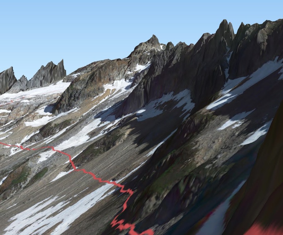 |
|
|
bmdhacks wrote: Wow, that's pretty incredible. Unfortunately everything around me is covered in trees so overlaying the sat imagery isn't as useful. If only I could find hi definition imagery from late fall or winter... |
|
|
That's so cool! Now to just figure out how to use QGIS. All I see is a sea of buttons and fine print... |
|
|
After an embarrassingly long time, I finally noticed the measuring tools in the Potree LIDAR app: 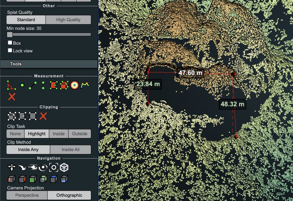 |
|
|
bmdhacks wrote: just started playing with blender so this is serendipitous information! |
|
|
Blender GIS is not gonna give you better information than just projecting google satellite tiles onto lidar height map in QGIS and viewing with the above 3js plugin. However, blender output will be way prettier if you spend the time with it. If anyone is making a guidebook where drones are forbidden, this might really be an amazing resource. |
|
|
bmdhacks wrote: Second. I would absolutely love to see LIDAR-derived artistic elevations in modern guidebooks, even if just for basic reference for the layout of an area but better yet than alongside the climbers topo. |


