
 Continue with onX Maps
 Sign in with Facebook


Onx App Reviews
|
|
I used the free trial recently. Very helpful. Do any of you use the paid app? Which one and what for? What's best for climbing purposes? |
|
|
I’ve got it, I live in Idaho. Primarily use it for climbing and mountain biking to make sure we are staying off private property as we try to access areas that are free use. It also lists the property owner and contact information if you do want to ask them for a blessing to use their land. There’s still a decent amount of unbolted rock/ routes to be cleaned and climbed around here, so it’s nice to check on the fly when driving around to see who owns the property and what the rules are as a lot of the land is BLM or farmers. You can also mark points and save trails super easy. Like cookies or waypoints on a gps |


|
I use it for fishing, otherwise google maps works just fine for climbing for me |
|
|
I personally use Gaia GPS and have been happy with it. Can create routes ahead of time and download offline maps for backcountry/cross-country trips. Lots of overlays for land management status. Neat slope angles feature for winter touring. I feel like these apps are similar to camera brands and their lenses, once you start planning, creating, and saving, routes you will have a hard time transferring to another platform. So do free trials on as many as you can and then commit :) |
|
|
Have a coworker who uses it exclusively for fishing and raves about it. I’ll probably hop on the wagon soon after hearing him say how good it is. |
|
|
Vitor Climbs wrote: I also use and prefer Gaia, and it now has a property boundary/ownership layer which had been the only real perk of ONX. Gaia to me has a much better user interface, is more intuitive, and has had less loading issues than I had when trying ONX. |
|
|
I pay for it, primarily for tracking my paths, seeing property lines, understanding elevation, and more. But often for finding trails and offline maps I use maps.me (free) |
|
|
Nathan Bilthuis wrote: It’s amazing for fishing. Great, but not as amazing for climbing in my experience. I’d ask to look/use at your coworker’s unless you don’t mind spending the money. |
|
|
Peter Thomas wrote: The one thing about OnX is they seem to do a better job updating property boundaries regularly. I wasn't using Gaia, but I was noticing caltopo didn't have as reliable (up to date) info on property boundaries. At least my local county's assessor site and OnX are always matching, which is great. The info on private lands is just owner name and tax address. I have had OnX annual for 3 years and the 'unlimited' one so it has all US states. It is really great for storing tracks and personal GPS coords. The offline functionality is pretty good and in airplane mode will only seriously drain battery if you have a gps tracker on and are checking regularly. And by drain I mean I had it in airplane mode for >1 day and was checking regularly. It is great for traveling IMO. When we went to Alaska and California it was nice to just use OnX instead of buying a local map. It misses some detail compared to a regular map but no biggie. Spatial data quality is generally pretty good. The cons: the more data you store the slower it gets, and the more layers you load the slower it gets. I have 600 gps coords and 42 gps tracks. It can be pretty buggy when I try to start the app on low battery or if I am in an area with a ton of my gps coords. Sometimes things are obfuscated in satellite imagery though like in the image below where shadows from when the image was taken/where the satellite was. Where as google maps generally has better satellite imagery and things are not obfuscated. If you do any sort of exploring or off trail things, it is really really good to have. If you just go to the same crags, not needed. The hunting app is the one you should get. The hunting app comes with enough layers for campgrounds, hiking trails, etc., in addition to helpful private/public boundaries and land classifications. Of the 3 apps, offroad backcountry and hunting, I've only used the hunting app though. 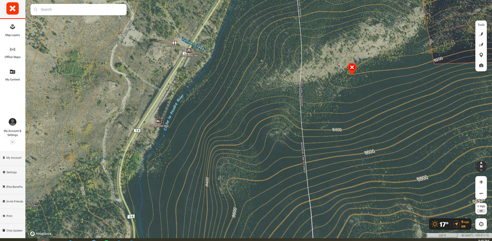 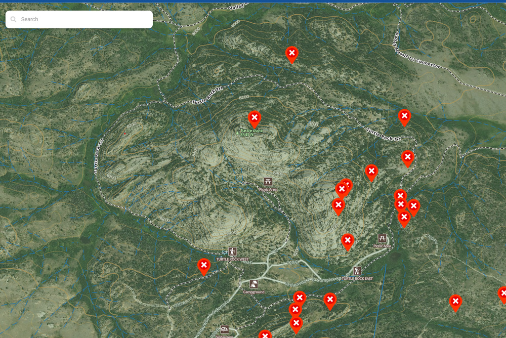 |
|
|
I did the free trial on the OnX offroader app. It was pretty cool but they need to have better community input like Mountain Project. Quality map apps like this plus community contribution will be the future. It was too expensive at $80 a year so I'm sticking with my Gaia GPS at $30 a year. I do climbing, backpacking, skiing and offroading. I don't want to buy apps for each of these sports. It would be ideal to have one that could switch modes. The offroad app has great details but not much better than Gaia for real navigation. It is nice to know property lines but not essential where I do most of my recreation. Offroaders have names for trails and routes and challenging obstacles that deserve to have community input like we do in climbing. |
|
|
Spider Savage wrote: Hooooman! I would like to see the forums on "Off-Road Project" Nawmean? But seriously, y'all are peaches, thanks for the info. |
|
|
I've had the hunt version for a couple years now. Happy enough that I'm upgrading to the elite version to have all 50 states. Got some traveling to do for spring turkey season. Keeps me on public land and gives a good idea of hard to get to places most hunters won't go. |
|
|
Any so-called GPS app that doesn't allow you to import and export GPX files from the app is a novel toy. Sadly, IMO there is no perfect GPS app right now. GAIA is very good, but lacks a lot of features like custom waypoint icons and bulk track editing that make it really hard to manage large libraries of data. Caltopo has the best desktop software and their app is good- if a bit clunky - but lacks the ability to have photos embedded in waypoints which for me is huge miss. [EDIT: Caltopo now supports photos!} All that said, The only pro that I see from OnX is the ability to view terrain in 3D -- however you can't do that offline... so you might as well use Google Earth which is free or FatMap which enables you to download 3D maps and has many of the features that OnX has. The available layers and customization you can do in GAIA or Caltopo are far better than OnX. |
|
|
I hate this f*^%ing app. |


