
 Continue with onX Maps
 Sign in with Facebook


Backcountry Skiing -Southern California


|
|
take TAKE wrote: The roads up to most of the mountain areas are still closed as of today. Questionable on if they'll open tomorrow. You could go up to Idyllwild area (chains required) otherwise your best bet would be to take the tram from Palm Springs up to San Jacinto. That's about a 1.5 hour drive to Twentynine Palms (I live in that area). |

|
Robertson Pearce wrote: I haven't seen much on this thread about San Jacinto, that I can recall. That does sound good, aside from not getting a feel for the terrain on the way up. Is there any place to find more info on the options from the tramway top? Or conditions? The avy conditions make me think the aspects leading from the top of the tram back to the bottom would be unsafe, especially solo. |
|
|
Hamik Mukelyan wrote: Dang, that sounds fun. I love it when we get these rare dumps. A few years back I played hooky, grabbed some skis and hit Charlton Flats for some fun. However, that's a few thousand feet higher than the Toll Road. Imagine how much more fun LA would be if it snowed even half as much more often. |

|
Lucy Freeland wrote: The nanny state does not allow such insanity. The entire SoCal budget has been spent on flashing lights and circling helicopters. Yet Mammoth was open and the road from Bishop to Mammoth was open by 11am on Wed Mar 1. Today, thursday, the simple trivial road to Mtn High is still closed, as is the desert road 18 to Big Bear. (edit: now open to special residents and deliveries of all goods such as televisions and stuffed toys). Do not ask questions, it's an emergency duh. 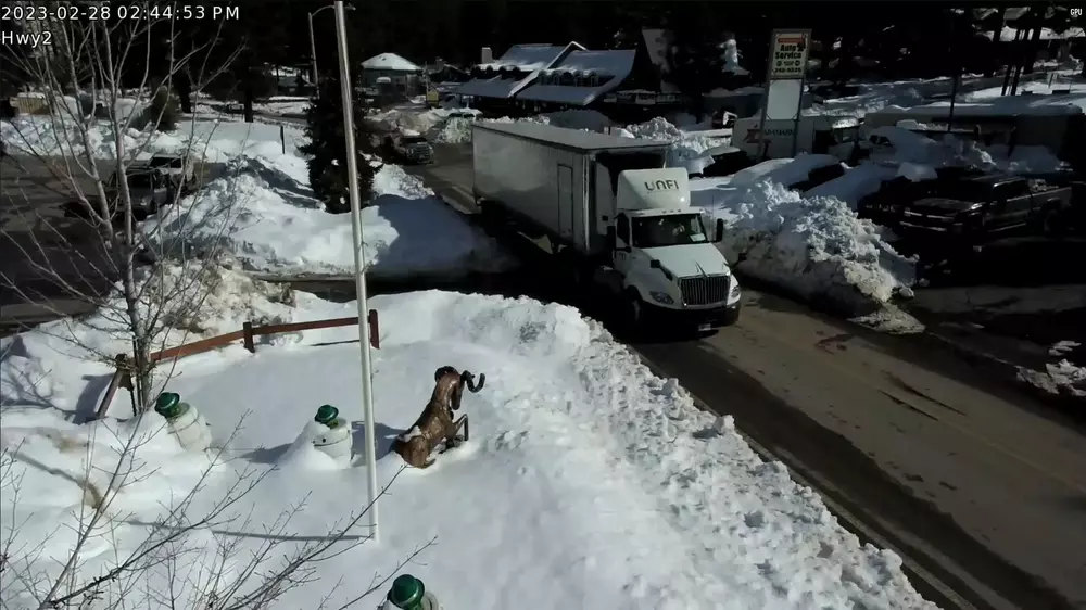 By 2/28 the road was bare and the snowpack as you can measure from this pic was 2 feet. But the road to Mtn High was still closed. Years ago after a storm the state managed to plow and open the west side of the Angeles Crest all the way to Waterman & Kratka, and on the east side all the way to Vincent Gap. Nowadays they refuse to plow to Vincent Gap, and quit at Sleepy Hollow at best. Despite having spent a fortune on fixing the road in between. |
|
|
To be accurate the 18 South in Big Bear is closed to non-residents, the word is it's cleared. |
|
|
Has anyone done any exploring in the San Diego area after this storm? I'm going to check out some spots around Cuyamaca and Mt Laguna this Saturday, any recommendations to check out? |
|
|
Lucas Shipley wrote: I made this map of potential spots to check out. Unsure as to which (if any) are skiable. But was looking for 20+% slopes at a high enough elevation that might not have too dense of brush cover. Might be headed out tomorrow to scope some. |
|
|
Colin Jaskiewicz wrote: I'm curious about the northeast slopes of Mt Laguna, looks like some potentially extreme terrain and given the winds during the storm they may have filled in real deep. |
|
|
take TAKE wrote: Its looking like they will be keeping the wilderness area off of the tram closed for the weekend. It sounds like this is as a precaution to keep SAR from being stretched too thin. Frustrating as this was the only area providing some opportunity for skiing. The terrain is pretty mellow and easy to manage. |
|
|
I've decided to accept the fact that no skiing will be had until next week at the earliest. Sigh. |
|
|
San Bernardino NF Emergency Forest Closure 03/03 - 03/16 https://www.fs.usda.gov/sbnf |
|
|
Welp. Mammoth it is then. |
|
|
Robertson Pearce wrote: Oh god I can't imagine how crowded it's gonna be up there. I've actually never skied Mammoth. Any tips? |
|
|
Bummer about Tram. and this other forest-order ! It's really been a battle with these closures. and yes that terrain to San Jacinto is 'mellow' but i think they were afraid of people hiking off the front-side where the tram arrives. I Slid by a semi-soft closure this AM on Big Rock Creek rd, and rode the N face of Baden-Powell. I was prepared for some conservative decision-making, (a solo outing) but much of the chute below the road had already slid, and higher up- things were quite bonded already it seemed. Summited by 8:15 am, did 3 laps on the upper part of face. Seemed like a valid option for tomorrow too. Or other obscure foothills near hwy 138. A splitboarder friend went yesterday and rode lower down, likely was better Thurs. Condiez were deteriorating by 10:45 am, but north facing and in the trees seemed good to go all day if not a little grabby. Good luck and keep the stoke alive <3      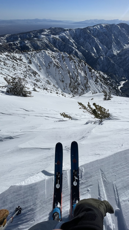   but even starting from the desert floor, its fairly easy getting into Independence peak chute, or even just scenic-touring the road to the summer parking for practice / some uphilling. Probably the eastside location i have toured the most, 'via-L.A.' - it's not that far. Another option might be Thor Peak (whitey zone) but you've gotta do the desert floor start as well. and plenty of new snow in the access chute. or just any foothills south of Big Pine. |
|
|
Hey, new to socal. I’d love to explore some skiing or whatever feels safe in Socal this week/weekend. Any good suggestions? Anyone wanna tag along for a tour somewhere? I’m up for anything. I’ve been touring a few years and have AIARE 1. Feel comfortable on most things but no expert. |
|
|
Some backcountry ski partners and I are planning a 5 day ski tour traverse around Kearsarge Pass in the Eastern Sierras. We are looking at the last week of April with some flexibility. This is definitely going to be like a backpacking ski tour type trip and not a base camp type trip. We are looking for a couple more people (we have 3 now but are hoping for a group size of 5). If you are interested DM and I'll forward more information. |
|
|
I guess the season is over. :( |
|
|
 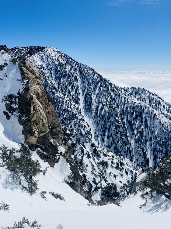 On March 4, I went up Icehouse and skied Pt. 8,688’ (between Bighorn and Ontario). After traversing back from the high point, descended via open slopes fall line/slightly skier’s right of Kelly Camp. All conditions were present, from wind board to pseudo corn to creamy pow to ice crusts. Skied easily to the car. Day for it. |
|
|
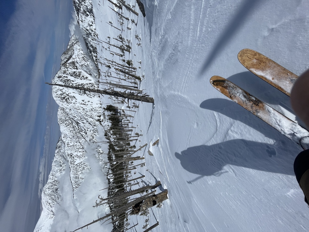
San G area Thursday 3/23 Conditions were outrageously good. Skin from and ski to car. Bluebird day, what more can you ask for! |
|
|
Awesome! Did you start at Jenks Lake? |


