
 Continue with onX Maps
 Sign in with Facebook


Linville Gorge- the mummy and the daddy
|
|
I am wanting to climb the mummy and the daddy sometime this fall and was wondering if someone would be willing to email me pictures of the guidebook for those climbs? Specifically not sure what the approach hike is or how to find the climbs once I get there. Thanks! |
|
|
The description on MP is pretty accurate, the GPS coordinates for the trail down to the amphitheater is 35.8729330, -81.8880060 Once you get to the descent gully in the amphitheater, just keep trending left and down to the start of the climbs. If there is a more defined trail down there ive never found it. Good luck and have fun, the climbs are a blast! |
|
|
It goes something like this... MST trail from Table Rock parking lot towards Shortoff, take a right turn at a 12" sized white quartz rock on trail (obvious), then a shallow descent for a third of a mile. You will reach a large flat boulder (something you could store a backpack under). Take a left to climb up over the boulder to a semi-hidden trail. This trail will lead you (thru some moderate downclimbing) around the Amphitheater to the rappel gully on the Mummy buttress. |
|
|
ayyyyyyyy, the daddy is a little off, that one is a general guide don't look too close 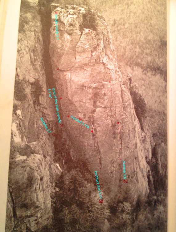 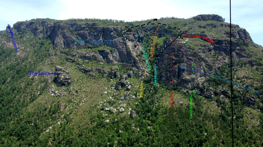 |

|
What I'll add to the approach beta is that the large flat gear storage rock can still be easy to miss if you're not paying attention. You can cruise over it really fast. If you approach a seasonal stream or start to come out into the open (and some amazing views of the amphi) you've gone too far. Finding the routes the first time will hopefully be the crux of your day. Good luck! |

|
The quartz can be easy to miss as well. It’s in the trail. If you start heading down a somewhat steep hill, you missed it. |
|
|
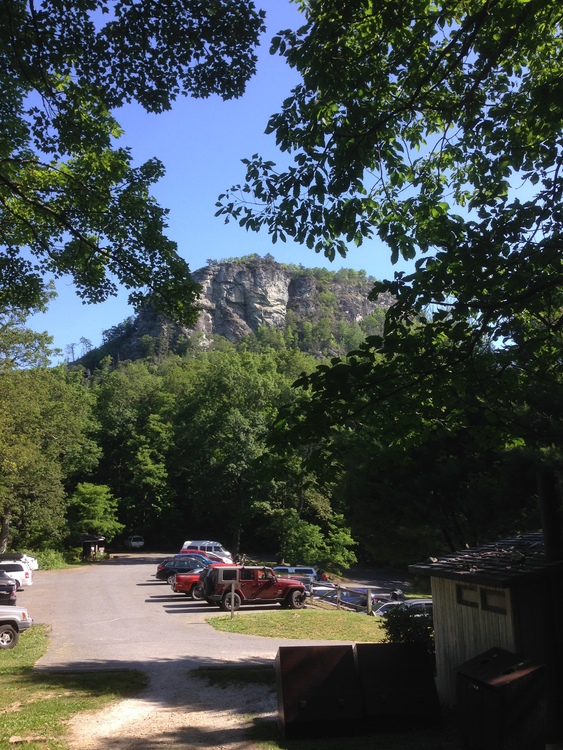
I would like to get back there this fall also. Mountain Project is spot on with the directions. Here is a view of table rock. This will be behind you as you start down the trail from the parking area. Sorry I didn’t take many pictures when I was there last. Let me know I f you are looking for a partner.
 |
|
|
Brian Payst wrote: I second the downhill beta. If you start going downhill, it's your cue to turn around. |
|
|
GPS coordinates for the turn off the trail down to the amphitheater is 35.8729330, -81.8880060 |
|
|
http://www.linvillegorge.net/gpx.php has some great maps (.gpx, and .kmz format) that show waypoints and tracks which'll definitely help you find the routes. I use locus pro to load that map onto my smart phone, but you might also look at avenza. |
|
|
DaveBaker wrote: +1 for linvillegorge.net..... those guys know every inch of that place... their GPX files are invaluable for the gorge. |
|
|
Jordan wrote: I took the .kmz file and imported it into the google earth app, I prefer it over avenza, just personal pref. |
|
|
Awesome! Thanks all |
|
|
I would suggest adding the prow to your day or you will have to find your way out of the gully. |


