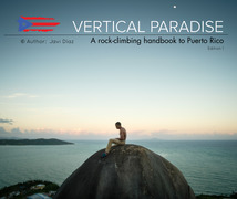
Surfers/Survival Beaches (Aguadilla) Climbing
Use onX Backcountry to explore the terrain in 3D, view recent satellite imagery, and more. Now available in onX Backcountry Mobile apps! For more information see this post.
| Elevation: | 27 ft | 8 m |
| GPS: |
18.5054, -67.14108 Google Map · Climbing Area Map |
|
| Page Views: | 73,557 total · 949/month | |
| Shared By: | Jrad Bille on Dec 30, 2018 · Updates | |
| Admins: | Heliodor Jalba |
Description

A wide area spreading over multiple beaches and hillside with a consistent amount of condensed climbing.
If you can help us keep developing the area, message us and let's chat about future improvements.
Getting There

Parking at Surfers Beach is the easiest way to access the area:
18.505133, -67.141414
Cliff Rd, Maleza Baja, Aguadilla 00603, Puerto Rico
https://goo.gl/maps/nh2npMPT7Mjns28m6
Walk on the beach to the first and second beach boulders or there is a highly trafficked path through the forest. Following it for 15-20 minutes leads you to Survival Beach and past many other developed sections of the area.
Classic Climbing Routes at Surfers/Survival Beaches (Aguadilla)
Mountain Project's determination of the classic, most popular, highest rated climbing routes in this area.
Weather Averages
|
High
|
Low
|
|
Precip
|
Days w Precip
|
Prime Climbing Season
| J | F | M | A | M | J | J | A | S | O | N | D |
| J | F | M | A | M | J | J | A | S | O | N | D |
Photos
All Photos Within Surfers/Survival Beaches (Aguadilla)
Most Popular · Newest · RandomMore About Surfers/Survival Beaches (Aguadilla)
Printer-FriendlyWhat's New
Guidebooks (2)

 Continue with onX Maps
 Sign in with Facebook


4 Comments