
 Continue with onX Maps
 Sign in with Facebook


Use onX Backcountry to explore the terrain in 3D, view recent satellite imagery, and more.
Now available in onX Backcountry Mobile apps! For more information see this post.
| Elevation: | 767 ft | 234 m |
| GPS: |
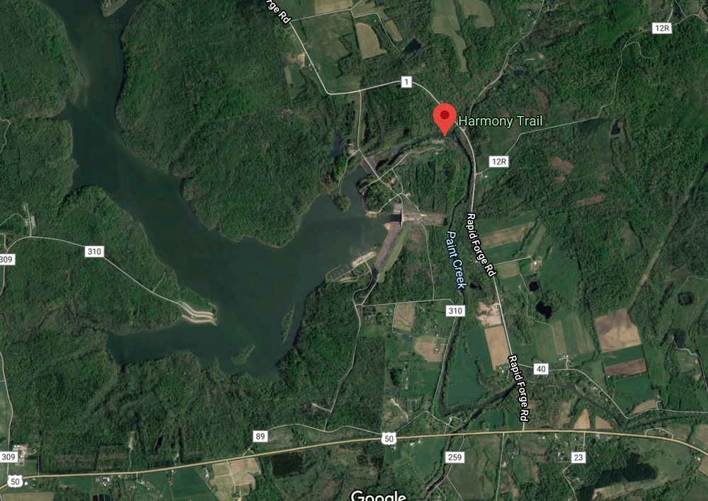
39.24979, -83.34637 Google Map · Climbing Area Map |
|
| Page Views: | 27,840 total · 173/month | |
| Shared By: | Nick B on Mar 3, 2012 · Updates | |
| Admins: | Courtney Curtner |
Description

Cliff face of Peebels Dolomite about 70 yards long with numerous routes. Stays in the shade all day.
Getting There
The climbing is located in the southeast portion of Paint Creek State Park near the Paint Creek Lake spillway. From US 50, take Rapid Forge Road to Reservoir Road. Take the first left to access the parking lot for the spillway/ Harmony Trail (the Army Corps of Engineer building is on the left after the turn so if you pass that you've gone too far). See map below.

Classic Climbing Routes at Paint Creek State Park
Mountain Project's determination of the classic, most popular, highest rated climbing routes in this area.

Weather Averages
|
High
|
Low
|
|
Precip
|
Days w Precip
|
Prime Climbing Season
| J | F | M | A | M | J | J | A | S | O | N | D |
| J | F | M | A | M | J | J | A | S | O | N | D |
Photos


All Photos Within Paint Creek State Park
Most Popular · Newest · RandomMore About Paint Creek State Park
Printer-FriendlyWhat's New


0 Comments