
 Continue with onX Maps
 Sign in with Facebook


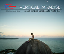
Monagas (aka Nuevo Bayamón) Rock Climbing
| Elevation: | 48 ft | 15 m |
| GPS: |
18.40919, -66.14117 Google Map · Climbing Area Map |
|
| Page Views: | 224,221 total · 1,135/month | |
| Shared By: | Greg Pfeil on Feb 19, 2009 · Updates | |
| Admins: | Heliodor Jalba |
Description

Monagas (aka Nuevo Bayamón) is the main crag in Puerto Rico due to its location within the main urban area and the number and variety of routes.
Many parts of this area are shady all day long, some are even in cave-like areas. When I was there it wasn't very crowded. I only saw one other couple climbing all day. Sometimes people walk up from the park to look around, but just spectators.
The limestone rock is nice: a mix of english-muffin cragginess and smooth candle-dripping laybacks.
GUIDEBOOKS & DONATIONS: Please consider purchasing the downloadable guidebook from Aventuras Tierra Adentro. The money goes to route maintenance. It is available as a downloadable PDF file from the website or as a paper booklet if you visit the store in person: goo.gl/maps/5BNETox8AmEmZyFt5 The owner of Aventuras Tierra Adentro is a cornerstone of the PR climbing community, and has developed and maintains many of the routes on the island. If you would like to donate directly, you can send your donation by paypal to aventurastierradentro@gmail.com. You can also donate to the local climbers association, AEPRI, a 501(c)(3) non-profit focused on keeping the climbing areas in Puerto Rico safe and accessible.
Getting There
The crags are in the park Julio Enrique Monagas in the municipality of Bayamón.
The park's current schedule has it closed on Mondays and Tuesdays (started in late 2023). It's not clear how long this restricted schedule will continue.
Coordinates for parking:
18.409135, -66.141252
https://goo.gl/maps/Yh7yZ4ukpAD2
Map of the hiking path that leads to the access trails for the crag:
https://www.mountainproject.com/photo/118270135
Map of the crag, sectors, and access trails:
https://www.mountainproject.com/photo/117370114
PARKING:
The park charges a parking fee, currently $4, 7am to about 2pm, when the gate attendant goes home. After the park gate, cross the parking lot and follow the road to the right. Right after passing this parking lot, turn right, which will take you to a second parking lot, within sight, between playgrounds and gazebos. Park here. This map has it detailed quite clearly: https://osm.org/go/Y0SufmJ~j--?m=
HIKING:
From the parking lot, hike up the tar road that heads towards the woods. Pass under a rain shelter structure onto a thin and paved path. It will curve sharply to the right, past several mountain bike trails. Right after, you'll spot a cement post with a carabiner picture. Take the mountain bike trail that goes to the left and uphill from here. Keep your eyes and ears open for bicyclists. It's a mountain biking trail so move aside and don't force them to slow down; they have the right of way. As you hike up, keep right at the first junction and left at the second junction. When you come out into a clearing or open area, there’s another carabiner picture; keep hiking straight ahead and up. Pass the wooden benches, on your right.
ACCESS TRAILS:
At the uphill left bend of the road right after the wooden benches, you'll have the first of two access trails on your right. It takes you to the sectors El Elefante, El Bloque, El Mamón, and further away. If instead you follow the left bend in the road uphill, there is a second access trail on your right side that will take you to the sectors El Pasillo, La Escalera, and El Puente. Lastly, if you walk all the way up to the observation tower, there is an access trail in the back of the turn as you circle the tower, which leads to the Ground Zero sector.
Climbing When Rainy

The rainy season can be frustrating for climbing. Rain showers will pass by frequently and the ground will be muddy on some days (and slippery!) but small or moderate amounts of rain doesn't mean you have to stay away. There are various caverns or overhanging routes that can have you climbing during the rain or immediately after. Check out:
Pasillo - the go-to for rainy moments, the back half is protected from moderate amounts of rain and features routes from 5.8 to 5.11
Ground Zero - two caverns that stay dry in moderate rain
El Mamón (Original) - Except for the easy jugs up top, the routes are gently overhung and stay dry in light short rain.
Urticaria East - the route "Urticaria" is especially likely to stay dry after small amounts of rain and its neighboring routes will dry up shortly after. The ground may be muddy.
El Bloque - circle it from end to end and see which parts have stayed dry.
El Lado Oscuro - short overhanging wall
Bichuflinqui - a bunch of overhung routes that stay dry in the rain
Classic Climbing Routes at Monagas (aka Nuevo Bayamón)


Weather Averages
|
High
|
Low
|
|
Precip
|
Days w Precip
|
| J | F | M | A | M | J | J | A | S | O | N | D |
| J | F | M | A | M | J | J | A | S | O | N | D |
Photos


All Photos Within Monagas (aka Nuevo Bayamón)
Most Popular · Newest · RandomMore About Monagas (aka Nuevo Bayamón)
Printer-FriendlyWhat's New
Guidebooks (3)


6 Comments