
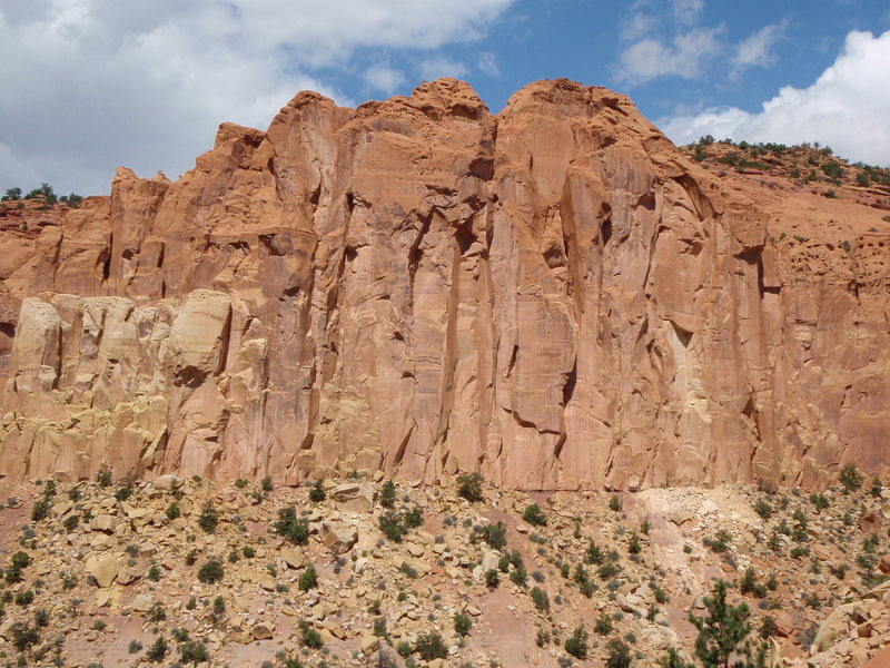
The best way is to drive to Boulder Utah and the signage is very well marked, it's one of the towns only tourism draws so locals will know where it is. Also at the entrance to the Burr Trail there is a nice restaurant/brewery to grab some beer and grub. Get on the Burr Trail road and head east until you reach Long Canyon. The climbing will be directly off the road and obvious.

 Continue with onX Maps
 Sign in with Facebook


Flagstaff, AZ
Utah
Email me @ buildingeye@gmail.com Apr 11, 2011
"The majority of areas suitable for climbing and canyoneering in the Monument are located within Wilderness Study Areas. Since wilderness preservation is part of BLMs multiple-use mandate, WSAs are managed so as to not impair the suitability of such areas for preservation as wilderness. Non-impairment means that activities within WSAs must be both temporary and create no new surface disturbance. Bolts and other fixed anchors do not meet these criteria. Therefore they are not allowed in WSAs.
According to BLM Manual 6330 Management of BLM Wilderness Study Areas, Rock climbing and caving are allowed as long as these activities meet the non-impairment criteria. The placement of permanent fixed anchors (e.g., bolts) or artificial holds is not allowed unless it meets one of the exceptions to the non-impairment standard, e.g. for emergencies, such as search and rescue operations. Any impacts from emergency actions must be restored to a substantially unnoticeable condition following the emergency situation. Generally, fixed anchors placed prior to FLPMA (Federal Land Policy Management Act, 1976) will not be removed unless their presence createsdirectly or indirectlyimpacts that exceed the non-impairment standard.
Long Canyon seems to be in two study areas. Steep Creek and North Escalante Canyons.
Nov 10, 2014
blm.gov/ut/st/en/fo/grand_s…
Now I look at this, it appears they have an ambitious WSA designation plan, covering large swaths of the monument. If so, this sucks in view of the restrictive climbing policy; there's areas that appear to fall into their WSA zoning that are utterly trashed by cows, tumbleweed hell. Maybe I'm reading the map wrong, the legend is unhelpful. I'm assuming that paler areas are supposed to be WSA? But the legend does not specify.
blm.gov/style/medialib/blm/…
Previously I was relying on their generic map here for guidance and it only shows the Vermilion Cliffs area as WSA, and everywhere else wide open, contradicting the maps linked above.
blm.gov/ut/st/en/fo/grand_s… Aug 2, 2016
Escalante, UT
I was thinking of reaching out to Access Fund to get some ideas on how to move development forward in the area. The Bears Ears Monument could provide a new precedent. Feb 1, 2017