The Joshua Tree National Park Superintendent's Compendium states that: 1. Vegetation is not allowed to be used as an anchor. 2. Only neutral or rock colored bolt hangers are allowed.
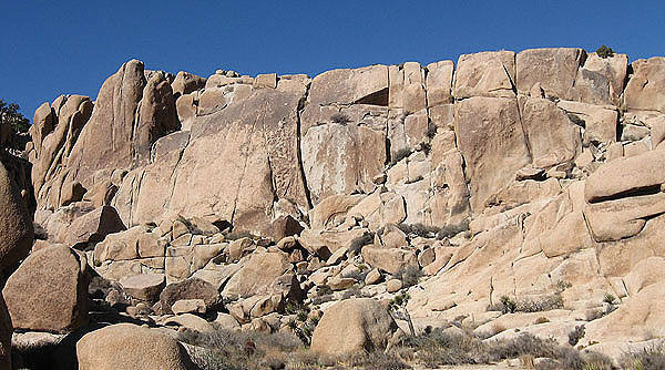
Cunning Rock is a long formation, north of the road, between Jumbo Rocks Campground and Live Oak Picnic area. The Southeast Face gets morning sun, and is therefore a good choice on a cold day. As with most other formations in the Jumbo Rocks area, the rock is quite coarse (even by Joshua Tree standards). This formation is called False Moosedog Tower in the 1992 Vogel guide.

 Access Issue: Climbing Regulations/Seasonal Raptor Closures
Details
Access Issue: Climbing Regulations/Seasonal Raptor Closures
Details

 Continue with onX Maps
 Sign in with Facebook


On the road, mostly Southwest