Mountain Project Logo
To save paper & ink, use the [Hide] controls next to photos and comments so you only print what you need.

Charlotte Dome

California > High Sierra > 12 - Kearsarge Pass t…

Description

Beautiful dome in the Sierra backcountry. Home to, as RJ Secor called it, "one of the world's finest rock climbs."

Getting There

Two ways:

1) From Cedar Grove, east up Bubb's Creek trail then cut left (north) on faint-use trail up Charlotte Creek, 7.5 miles 4,500 ft elevation gain.

2) From Onion Valley, over Kearsarge Pass, down to Charlotte Lake, then down to Charlotte Dome: 8.5 mi to Charlotte Lake (2600ft gain in first 5mi to KP, 1400 loss next 3mi to CL), 3.5 mi from CL to the base of SF, CD. 13mi total, from OV parking lot to base of route.

8.5mi and 2100ft gain from walkoff of SF to top of KP, then 4mi downhill (2500ft descent). 12.5mi total to parking lot at Onion Valley   9.5 miles 3,500 ft elevation gain (on the way out! c2500 ft on the hike in).

You decide which way you want to go. Living in LA I favor the western approach (1); it's all downhill on the way out.

Campsites here are wonderful, in deep forest, and hopefully no one else around. Watch out for bears! Take precautions. Bear cannisters are mandatory on both approaches.

Routes from Left to Right

5.8 5b 16 VI- 15 HVS 4c R
 2
South West Arete
Trad, Alpine 7 pitches
5.8 5b 16 VI- 15 HVS 4c
 271
South Face
Trad, Alpine 12 pitches
5.10a 6a 18 VI+ 18 E1 5a R
 1
Stop that Train
Trad, Alpine 11 pitches
5.11c 6c+ 24 VIII- 24 E4 6a
 12
Against the Grain
Trad, Alpine 10 pitches
5.7+ 5a 15 V+ 13 MVS 4b R
 1
The Epic-cureans
Trad, Alpine 12 pitches
Route Name Location Star Rating Difficulty Date
South West Arete
 2
5.8 5b 16 VI- 15 HVS 4c R Trad, Alpine 7 pitches
South Face
 271
5.8 5b 16 VI- 15 HVS 4c Trad, Alpine 12 pitches
Stop that Train
 1
5.10a 6a 18 VI+ 18 E1 5a R Trad, Alpine 11 pitches
Against the Grain
 12
5.11c 6c+ 24 VIII- 24 E4 6a Trad, Alpine 10 pitches
The Epic-cureans
 1
5.7+ 5a 15 V+ 13 MVS 4b R Trad, Alpine 12 pitches

Photos [Hide ALL Photos]

Charlotte Dome from the eastern approach. Descent goes down the right skyline to the notch, then down the curving gully past the trees.
[Hide Photo] Charlotte Dome from the eastern approach. Descent goes down the right skyline to the notch, then down the curving gully past the trees.
The ramp traverse.
[Hide Photo] The ramp traverse.
Miguel Carmona took this picture of me in August of 1983 on the South Face route.  What a wonderful climb!
[Hide Photo] Miguel Carmona took this picture of me in August of 1983 on the South Face route. What a wonderful climb!
Nearing the end of the westside approach
[Hide Photo] Nearing the end of the westside approach
Peter Croft's summit registry thoughts.
[Hide Photo] Peter Croft's summit registry thoughts.
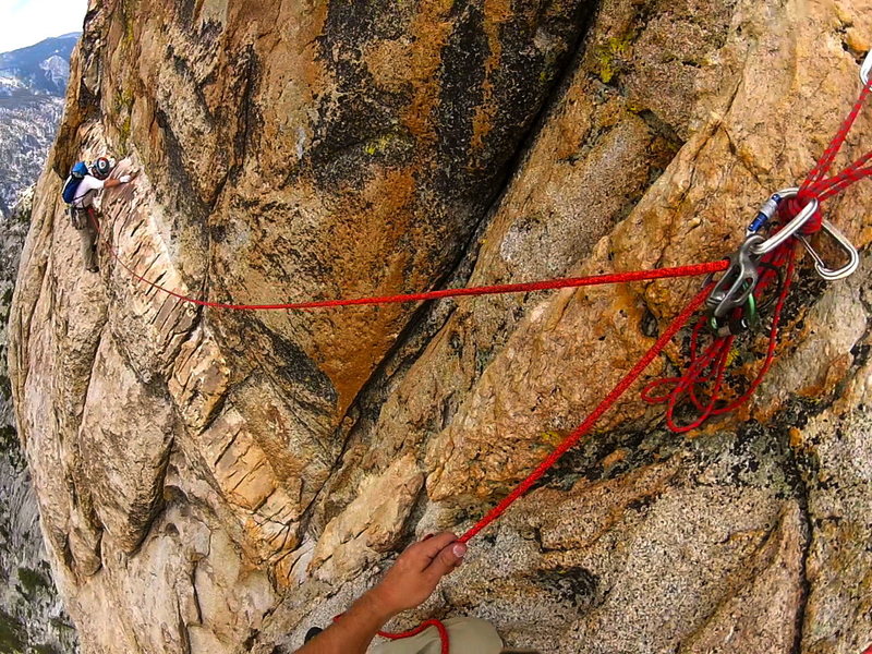
Pulling the small roof on the "slot" pitch. Protects well.
[Hide Photo] Pulling the small roof on the "slot" pitch. Protects well.
With Pops after a successful trip.
[Hide Photo] With Pops after a successful trip.
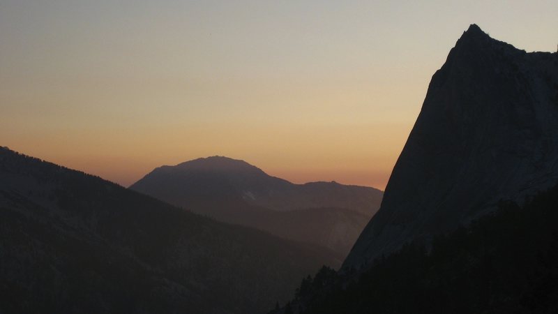
Charlotte Dome at sunset
[Hide Photo] Charlotte Dome at sunset
Dawn halfway up the wall
[Hide Photo] Dawn halfway up the wall
Campsite on the eastern shoulder of Charlotte Dome.
[Hide Photo] Campsite on the eastern shoulder of Charlotte Dome.
All the way from Kearsarge Pass
[Hide Photo] All the way from Kearsarge Pass
Charlotte Lake
[Hide Photo] Charlotte Lake

Comments [Hide ALL Comments]

karl wilcox
Weimar, CA
[Hide Comment] The standard Charlotte route can be very crowded in the present era of tick lists. In my view the best time to climb is Sept. or Oct. Colours are great, and nobody is around. Route finding is key on this route-- in the 1970's it was truly hard to know if one was on route, now Peter Croft's guide book offers much greater certitude. I always camp at the lake with the bear boxes and the ranger station (coming in over Kearsage pass; eastside), as in the late 1970's we lost our food when we camped closer to the dome. I seem to always need a headlamp for the walk back to camp at the lake. With two clients it seems that the route takes about 10 hours from camp to camp (Lake Camp), but in the Fall this means some dark-time walking. Feb 1, 2007
Bruce Willey
Bishop, CA
[Hide Comment] From what I hear the bears in the area are on parole, serving time after being "problem bears" in the Valley. We had a big cinnamon-colored bear pick up a fuel canister near our heads, cart it off a few feet away and explode it in its mouth. It was last seen heading for water. Not a pleasant experience for the bear and I offer my apologies for not putting the fuel canister in the bear canister. The next day, after climbing the South Face, we were heading up the valley towards the Charlotte Lake and we ran into what looked exactly like the same bear. He or she stared us down and started walking towards us. Prudently, we started up the manzanita slope. The bear followed us and I picked up a useless tree branch. To be continued... Jun 10, 2007
Chris Owen
Big Bear Lake
[Hide Comment] Late season is good to avoid the crowds but be prepared for bad weather - got seriously rained on one Labor Day weekend, about halfway up, water just pouring down the rock, freezing cold, bit of an epic.

I often wonder what it would be like in the depths of winter....

Roper's 50 Classic Climbs is also a great resource because it has a few photos on route, helped me a lot when I first did it in the 80's. Oct 14, 2008
Chris Owen
Big Bear Lake
[Hide Comment] I've been going to the Sierra for 30 years and i can honestly say I had only one bear problem trip; it was a trip to Charlotte Dome. A small cinnamon bear bugged us twice in the night, shimmying up the tree where we had hung our food and we had to resort to throwing rocks at it, upon which it came right back down the tree, came at 9 then 12. The next day after the climb of the South Face we heard a large branch snap near our camp in the woods, ran into camp to see a huge black bear standing there; we kept running and shouting and it ambled away.

That was back in the early 90's before the canister regulation. Once they issued that i stopped rock climbing in the backcountry, my pack was too heavy and it kinda took all the fun out of it. Jul 3, 2014
Lindsey Isaacson
Nashville, TN
[Hide Comment] West Side Approach Notes: The hike from Road's End to Charlotte is pretty casual, though the switchbacks up Bubb's Creek can be relentless. The "faint trail" leading to the base of the dome from the NW side of Charlotte Creek is mostly a cairned route up a 45 degree angle slope of exfoliating granite. Carrying camping gear and climbing gear would be brutal. Depending on your fitness, from Charlotte Creek expect 2 hours and change for the approach.

Descent Notes: Bushwhacking is almost a definite. Wear pants. From the summit block it is about a 3.5 to 4 hour walk back to Charolotte Creek if you catch it in the daylight and follow the "trail." The sunsets from the top of Charlotte Dome are epic.

Rack Notes: We brought a 60m 8mm rope, a single rack from 0-#3, a set of nuts, and about 8 runners. It was perfect for the South Face.

Bear Notes: There is currently a light brown mother and two cubs patrolling the area between Charlotte and Sphinx Creeks. They appear to be just bears doing bear things - falling out of bushes, turning over rocks, being cute in general. Store your smelly things properly so they can keep being cute instead of having to be destroyed. Aug 7, 2015
Bill Lawry
Albuquerque, NM
[Hide Comment] East Side Approach Notes:

A SuperTopo guide purchased this year (Second Edition, 2013, ISBN 978-0-9833225-3-5) describes how to find the truly great campsite on the east side of Charlotte Dome. However, the suggested camp site is neither "up against" the ridge nor at 10,140 feet nor next to a "spring". And the "moraine ridges" were a little unrecognizable in the forest at dusk / dark. And, being unfamiliar, I could not recognize the old trail that goes up to Gardiner Pass. Also, we wanted to conserve smart-phone battery and so relied mainly on the SuperTopo description words rather than lat / lon ... and spent half of the next day searching with full packs for a camp site in which we had already spent the night. :)

If you have the same SuperTopo guide, I would modify - and shorten - that description to read: "Once finally back in the woods, keep heading toward the ridge that runs off the north side of Charlotte Dome by following the mostly-frequent cairns along a faint path. Look for a great campsite (36.7861 deg N, 118.4743 deg W, elevation 9,800 feet +/- 55 feet**) that lies about 100 feet above and east of a very lush and noisy creek down in woods."

Otherwise, I think the SuperTopo description and topo were great. Not sure how to submit this to SuperTopo folks - maybe I am too lazy?

** was using iPhone 5s and app "Altimeter+" by Sichtwerk AG, version 2.1 in GPS mode (i.e., not ASTER mode)

Edit to add: corrected above elevation. Sep 6, 2017
Chris Owen
Big Bear Lake
[Hide Comment] 98,000 feet? You must've been in the ISS flying over. ;-)

I camped in a nice clearing above Charlotte Creek - there was even a fire ring there.

Approximate location of this is:

36.782192, -118.467786 EL 9200ft. Sep 7, 2017
Mike Womack
Orcutt, CA
[Hide Comment] My TR from Summer 2018. Probably my favorite climb so far!

sierraexperience.blogspot.c… Feb 18, 2020