Continue with onX Maps
 Continue with Facebook


Santa Fe National Forrest Climbing
|
|
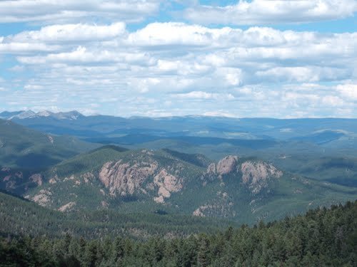
Anyone ever do any backcountry climbing in the Santa Fe National Forrest. I was looking specifically East and SE of Lake Peak. There seem to be some large rocks on google earth; here's one... Lat 35°46'16.88"N Long 105°44'12.42"W just trying to see what's up in the area. thanks for the help. cheers, |
|
|
man, I'm really surprised no one has any knowledge of these cliffs. Is the rock just choss or something? attached is a photo of one along with the lat/long |
|
|
Hey Scott |
|
|
what's the snow situation like out there right now? |
|
|
Your picture is of "Dos Gigantes." |
|
|
Tonto wrote:Under the Radar as in: I moved here from the East Coast and now this is MY local climbing area, you can't use it, your not cool enough. LOL.Who are you to put words in my mouth? Who are you, period? I shared all the beta I have about the place. I have other, bigger rocks to deal with instead. By under the radar, I mean: our stuff is generally obscure, rarely visited, poorly reported, mainly shared among friends through word of mouth, and is reserved that way so the next set of shmucks can have the same exploratory adventure. So don't expect too much information to be forthcoming to a random internet inquiry, even if people do have knowledge of the area. That's what I mean. To the OP: Go take the ropes for a walk and see what you find. Maybe it's awesome. What I do know is that Shaggy Peak, farther west of your area of interest, has some decent quality granite, but it's not really big enough to bother with. But the stone quality isn't horrible there, at least. |
|
|
thanks y'all, I appreciate under the radar. I like the unknown. I'm not really looking for route beta, just whether it's something people like to climb on or a pile of junk. anyways, I'll check it out myself. I live down in west texas where it's been 90degrees already... is it too snowy to drive in to a place like this yet? cheers, |
|
|
What is your projected approach, Scott Chapman - down from Penitente or up from Holy Ghost CG? The high country is still snowbound on the northern aspects above about 11K & Holy Ghost road is closed until May regardless of snow. Nice to think this wasn't choss but it does face the exact reverse (i.e., SE) of the Pecos crags downriver whose quality might best be rated as 'good'. Good luck & be sure to post what you find ... |
|
|
I just drove out to the cliffs. I don't know if it's worth the drive unless you have a lifted 4wd vehicle. Took me about 1-2 hours just to drive there from pecos area. The cliffs look like they could have potential but I am unsure of the rock quality |
|
|
Here are my only 2 up close shots of this/these formation(s) plus a Google image showing where they were taken (yellow X at bottom), the first looking NE, the second NW ... 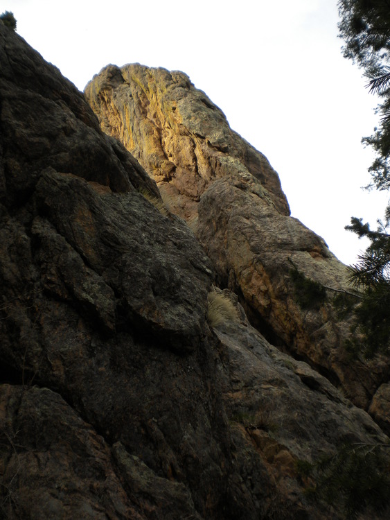 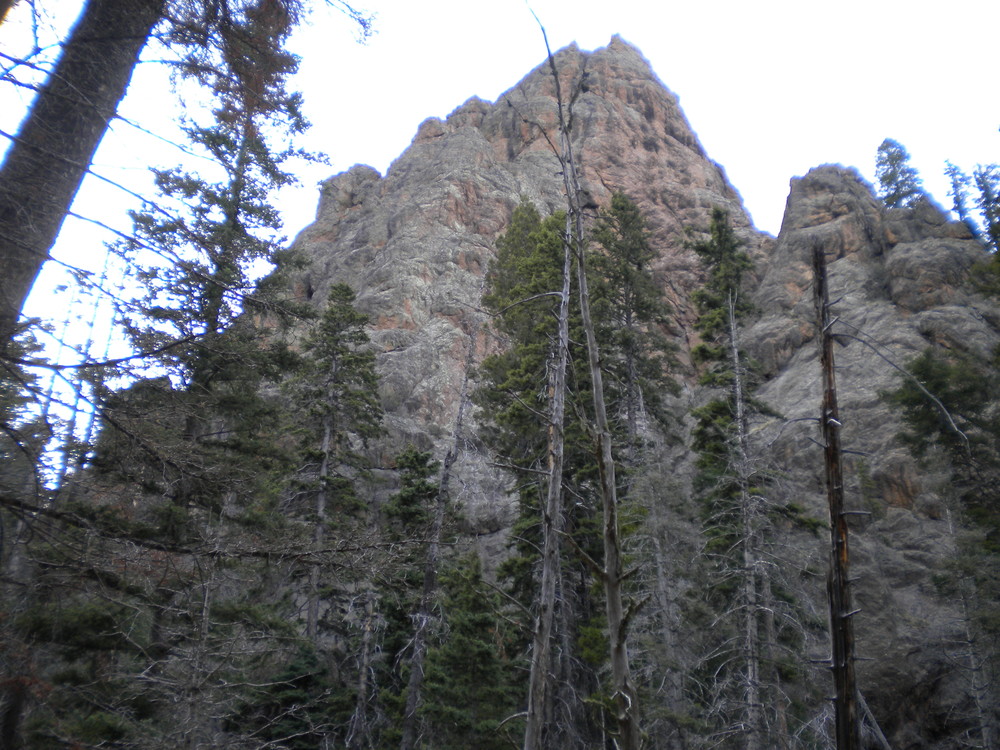 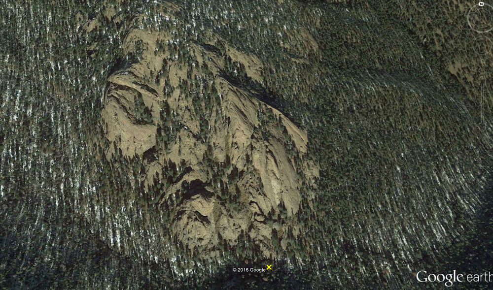 I've been sitting on these pictures a while, ever since about a year after I first saw this thread, not sure I wanted to share what I found there ... however, I think maybe it's time ... the area is so densely overgrown I had to bushwhack several hours before getting these shots right before dusk ... it's no Questa & or even the Organs, but it is granitic, well weathered if not well fractured ... a section of rock I touched on the east side was hard & smooth grained, but five feet away it crumbled under my hands ... what I would like to know is how Cameron got a vehicle in there ... I parked at the gate to Holy Ghost CG & hiked about 2 hours up Doctor Creek along a rough but clear track ... it's a beautiful hike & I would do it again if I thought the rock was worth the effort ... I could be wrong, of course, as I didn't get to nearly every part of the formations ... & I might rethink that if I knew I could drive close to it, but as it is ... have at it, brothers! |
|
|
|

|
Scott if you're still into it I'd love to go check it out with you after New Years if there's still no snow up there.. Looks like a good adventure! |
|
|
Mark Dalen wrote: When i first drove out there, i did run into that gate you are talking about. but the way to get there is to take the 123A, which on google maps is named Macho Canyon Rd, at the large dirt area. If you zoom into the base of the cliffs on google maps you can see a road in the area. I just had to follow the roads down there. but it is a horrible road that hasn't been maintained in a long time it looks like. NOT for 2wd vehicles. There are is a limited amount on turn around points so in some cases you will be committed to continue driving down the road. I took a Jeep Liberty not knowing what to expect and realized that wasn't the correct vehicle. This is the route i took to get there. 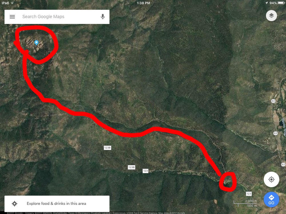 |
|
|
Chris Wenker wrote: What I do know is that Shaggy Peak, farther west of your area of interest, has some decent quality granite, but it's not really big enough to bother with. But the stone quality isn't horrible there, at least. Shaggy is a fun scramble from the west, though you have to deal with some private property and bush-whacking. I think you can see the crags in question from SF, but the watershed gets in the way. Interesting to read that someone has explored them. |
|
|
Cameron - okay, it looks like we're talking about two separate formations here, based on differing coordinates given in the first two posts ... the site I visited & photographed lies at the coordinates given in the first post, that is to say roughly 35 46 20 N & 105 44 14 W ... the second post's aerial photo shows the site you drove in to, well to the south ... it could still be that roads go near the Doctor Canyon formations, but not the Macho Canyon road as far as I can see.... |