
 Continue with onX Maps
 Continue with Facebook


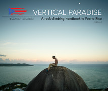
La Escalera Rock Climbing
Routes in 04. La Escalera

|
ADD S 5.10b 6a+ 19 VII- 19 E2 5b |

|
Al Lloro S 5.10a 6a 18 VI+ 18 E1 5a |
|
|
Amor S 5.8 5b 16 VI- 15 HVS 4c |
|
|
Bee Attack & Wenguie's Revenge S 5.10d 6b+ 21 VII+ 21 E3 5b |
|
|
Born Free S 5.8 5b 16 VI- 15 HVS 4c |
|
|
Claudia Isabel S 5.8+ 5b 16 VI- 15 HVS 4c |
|
|
DDD S 5.8 5b 16 VI- 15 HVS 4c |
|
|
Dolphin Attack S 5.10b/c 6b 20 VII 20 E2 5b |
|
|
Guerra S 5.10a 6a 18 VI+ 18 E1 5a |
|
|
Independence Day S 5.9 5c 17 VI 17 HVS 5a |
|
|
Jadihel S 5.9 5c 17 VI 17 HVS 5a |
|
|
La Cueva del Alacrán S 5.8- 5b 16 VI- 14 VS 4c |
|
|
Paz S 5.8- 5b 16 VI- 14 VS 4c |
|
|
Shark Attack, The S 5.10+ 6b+ 21 VII+ 20 E3 5b |
|
|
Tierra a la Vista S 5.9 5c 17 VI 17 HVS 5a |
|
|
Unnamed S 5.12a 7a+ 25 VIII+ 25 E5 6a |
|
|
Where's the Crux? S 5.10c 6b 20 VII 20 E2 5b |
|
|
Yan Gabriel S 5.9- 5c 17 VI 16 HVS 4c |
Order Wrong?
Sort Routes
Use onX Backcountry to explore the terrain in 3D, view recent satellite imagery, and more. Now available in onX Backcountry Mobile apps! For more information see this post.
| Elevation: | 256 ft |
| GPS: |
18.4057, -66.14427 Google Map · Climbing Area Map |
| Page Views: | 20,564 total · 112/month |
| Shared By: | Greg Pfeil on Feb 23, 2009 · Updates |
| Admins: | Heliodor Jalba |
Description

This area is sunk a bit lower than the surrounding trail. It tends to stay wet longer than other areas and generally is pretty humid. However, the routes are a bit easier and it makes a good warm-up area.
Getting There
Follow the main trail for a while, and look for a break in the trees on the right that leads to a descending wooden staircase.
Map of the crag, sectors, and access trails:
https://www.mountainproject.com/photo/117370114
To get your bearings and identify the routes in this sector, as you descend the wooden staircase, in front of you will be a rock face containing the leftmost three routes of the sector, Guerra, Paz, and Amor. The top of it looks like this: https://www.mountainproject.com/photo/115359268
Classic Climbing Routes at La Escalera
Mountain Project's determination of the classic, most popular, highest rated climbing routes in this area.
Weather Averages
|
High
|
Low
|
|
Precip
|
Days w Precip
|
Prime Climbing Season
| J | F | M | A | M | J | J | A | S | O | N | D |
| J | F | M | A | M | J | J | A | S | O | N | D |
Photos


All Photos Within La Escalera
Most Popular · Newest · RandomMore About La Escalera
Printer-FriendlyWhat's New
Guidebooks (3)


0 Comments