
 Continue with onX Maps


ID 108279306 ·
·
Copyright Violation?


Rate Photo

 5.0
from
24 votes
5.0
from
24 votes
Mike Barron
Aug 7, 2013
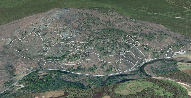
“A Google Earth view of Rumney with trails mapped using GPS.
The thicker lines are the major trails. The thin lines are the minor trails.
The black lines are the individual crags.
A more detailed satellite image was overlaid because it shows the exposed rock better.”


The thicker lines are the major trails. The thin lines are the minor trails.
The black lines are the individual crags.
A more detailed satellite image was overlaid because it shows the exposed rock better.”


7 Comments