
 Continue with onX Maps


ID 108358251 ·
·
Copyright Violation?


Rate Photo

 5.0
from
2 votes
5.0
from
2 votes
Kate Mittendorf
Sep 28, 2013
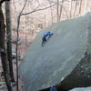
“Here's a map based loosely off the map in the Ulner guide, but done from memory. Red ATCs represent accessible anchors for rap points, brown paths over the cliff represent places I know are safe to scramble in. Blue is the creek bed, and brown are the cut across paths. The paths2013-09-289508.53.34.jpg2013-09-289508.53.34.jpg on the bottom and top of the cliff are not marked”


2 Comments