
 Continue with onX Maps


ID 106088657 ·
·
Copyright Violation?


Rate Photo

 5.0
from
3 votes
5.0
from
3 votes
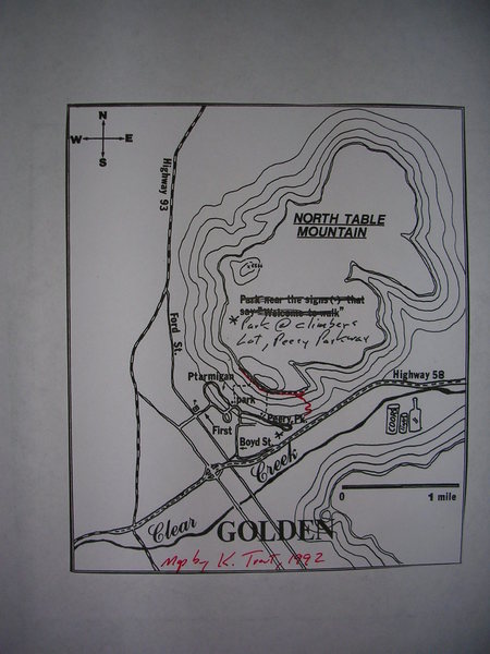
Ken Trout
Jan 8, 2008
“An old map I made in 1992. Red line shows where the climber's trail goes now. This map was part of an article in Rock & Ice, 1992. I also added my topo's for Brown Cloud Crags, Overhang Area, Industrial Buttress, and Winter Warmer. Except for the new routes at Winter Warmer, no attempt was made to add all the routes that have gone in since '92. I thought the locator insets might be of use to others since all the books are out of print.”


0 Comments